• Shops and businesses

  • Red House Park

  • Hamstead history

  • Public Houses

  • Hamstead village

Copyright 2024 - Custom text here

Hamstead

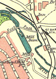
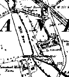
Hamstead is a loosely defined area spreading from its historical origin near the crossing of the River Tame, towards the Newton Road along Hamstead Road and towards Scott Arms on the Old Walsall Road. It is bounded by the River Tame and theTame Valley canal.

The name Hamstead has been used in the distant past to relate to two different areas. Across the river Tame from the current Hamstead is the Hamstead Hall area. Hamstead Mill was also in this area. This came under the historic area of Handsworth.

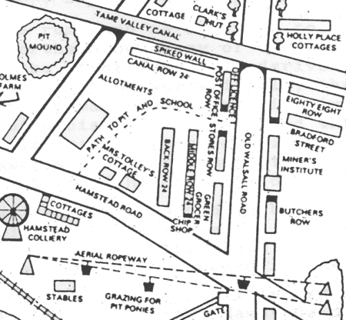
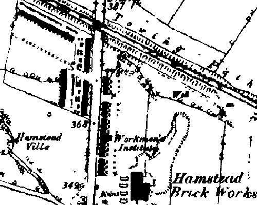
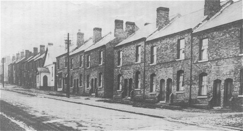
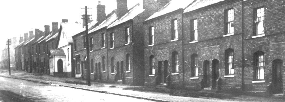
Historically the key feature was the Hamstead Colliery which changed the area from being rural into a mining community. Nowadays the mine is just a memory and has been built over with houses in Walcot Drive and Amberley Green. The original pit baths became a social club linked with the West Bromwich Albion, later the  Kings night club and more recently was built on with housing.

Nationally there are only two Hamstead's (without the 'p'), the other being on the Isle of Wight. There is also a place called Hamstead Marshall in West Berkshire.

Old Walsall Road

The Old Walsall Road links Hamstead Village to the Walsall Road. Originally it was the main route from Birmingham to Walsall until the new turnpike through Perry Barr was made in 1831.

When the main shaft of the Hamstead mine was completed, the call went out for miners to work the coal-faces. Hamstead was then only a sleepy hamlet and not ready for an influx of miners. The housing shortage was met by rows and rows of small two-up, two-down terraced houses being built in a very short space of time. They were uniform brick dwellings with no unnecessary ornamentation, and as they sprang up they would adopt the name of the principal building in that particular row. Hence we had "Police Row", "Butchers Row", "Canal row" and more oddly "88 Row" taking shape. This latter row was so-named because on the wall of the end house there was picked out in blue brick " 1888"

. Map showing old houses on Old Walsall Road

From Hamstead Herald 1986.
The different rows shown on the plan did not go all the way down to the Hamstead Road as indicated in the plan as Hamstead House was situated here.


oldwalrd1890.jpg (70K)

The white building in the photograph below is the "Workmans Institute" on the map above.

oldwalhouses.gif (133K)

Amongst the many shared facilities of this time was the Wash-House, which each house-wife used in turn for the family wash. A lane branching off to the left beside the canal, and officially named Canal Row, became known locally as Maiding Tub Row because of this hot bed of Monday activity.

Hamstead Cottages East later became Bradford St.

Hamstead Mill

While Hamstead Mill is 'just over the border' as far as B43 is concerned it is one of a number of mills that used to sit along the border of our area.

This mill was the manorial grist mill. The Domesday book entry which is believed to cover this area states:

William, the son of Ansculf, holds of the King and Walter of him, five hides in Hunesworde. Land of five ploughs; now in the demesne; two ploughs; eight villeins have one plough and a half. There is a mill of eight shillings, and twenty acres of meadow.

1950's map showing Mill Dam1890 map showing Hamstead Mill